EL NIÑO
"THE MASTER OF DISASTER"
SCENARIO:
A major international insurance company
(RamInsure) and the World Bank have asked the ACES (Atmospheric Conditions and
Environmental Specialists) to predict the effects of the developing
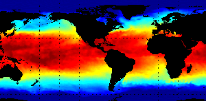
El Niño
on global weather and the economies of certain counties. They would
like to know how this El
Niño event compares with the
1982-83 event. The predictions will assist the insurance company and
the World Bank in reallocating funds to cover expected costs due to
the effects of the El
Niño. The sites of interest to
these companies are Australia, South America, and the west and east
coasts of the United States.
Internet Resources:
Procedure:
- Students download the information on the El
Niño of 1982-83, the strongest and most devastating of the
20th Century. (http://www.stormfax.com/ninoyear.htm)
- Students locate the following cities on a
world map, Sydney Australia, San Diego California, New York City
and Chiclayo Peru.
- Students locate and graph the mean
temperatures and precipitation of each of the cities for the
months of December, January, and February for the year 1982-83.(
http://www.ncdc.noaa.
gov/ghcn/ghcnV1.CLIMVIS.html)
- Students collect and graph the mean
temperatures and precipitation of the same cities during the
current year, same months.
- Students draw conclusions as to whether or not
the current El Niño has had an affect on the cities and or
surrounding area. Students should report on weather related
affects such as drought, flood, snow, etc.
- Students write a report to the Raminsure
Insurance Company outlining the possible consequences of the El
Niño's effects. For example, if the students predict major
flooding they should alert the company as to possible claims
against their flood insurance policies. Students will report to
the World Bank on such things as lost revenue from Australia and
South American countries adversely affected by the El Niño.
Their reports should include reasons for the expected
losses.
Students may continue the El Niño study,
however when data is collected it should be for a minimum of 3 months
at a time. Local conditions and averages should be graphed for visual
comparisons. Other cities around the world may be studied as well.
Different months may also be studied.
Related Sites:
Return to Previous Page
Last Updated: 10/21/97